USAID DEC
C ia Lagoon Watershed Management Project
The Cia Lagoon Watershed Management Project is a geographic initiative focused on the Cia Lagoon area.
1 pages
Sign in to readA free account is required to download.
Abstract
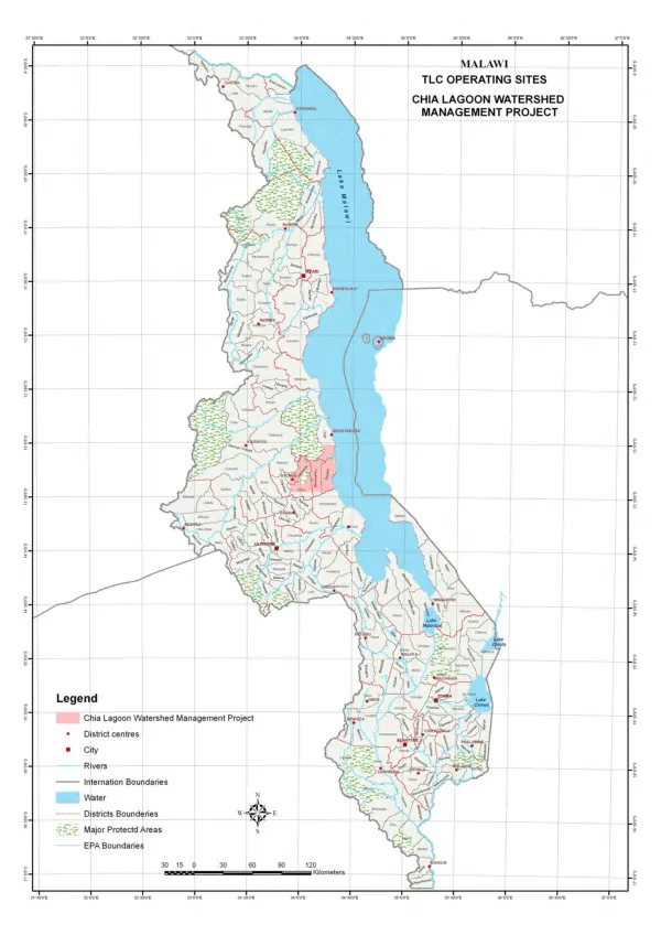
The project's scope encompasses a region bounded by international borders, with key locations including 31"30'O"E, 32"O'O"E, 32"30'O"E, 33"O'O"E, and 33"30'O"E. Implementation details for the project are not explicitly stated, but a series of rating sites, denoted as TLC 0 ERATING SITES, are identified within the project area. These sites are situated near the Cia Lagoon and are likely used for monitoring and assessment purposes. The project also appears to be bounded by district centers, cities, and major protected areas. A map of the project area is provided, featuring a grid system with latitude and longitude coordinates. The map highlights various locations, including 34"O'O"E, 34"30'O"E, 35"O'O"E, 35"30'O"E, 36"O'O"E, and 36"30'O"E. The project area is also bounded by international boundaries, with the East African boundary marked on the map. The map also features a series of lines and symbols, including a dashed line representing the international boundary, a solid line representing the district boundary, and a series of dots and lines representing protected areas. The map is divided into sections, with latitude and longitude coordinates marked at regular intervals. The project area is situated in a region with a range of geographic features, including water bodies, protected areas, and urban centers. The project's focus on watershed management suggests a concern for environmental sustainability and conservation.