USAID. MISSION TO SENEGAL
National plan for land use and development
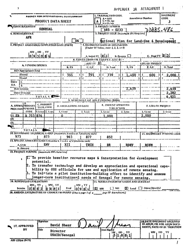
Project to help the Government of Senegal (GOS) to prepare a National Plan for Land-Use and Development (PNAT).
1981
Sign in to readA free account is required to download.
Abstract
The project, to be implemented by South Dakota State University (SDSU), will: (1) prepare photomaps for the PNAT; and (2) train GOS personnel in remote sensing and interpretive techniques. SDSU will improve and broaden the existing analyses of the 13 different Landsat scenes of Senegal, most of which have multiple data coverage back to 1972; SDSU will use temporal analyses of different years and seasons in order to gain an understanding of changes caused by climatic and human pressures on the land. The 13 Landsat images, along with existing reference maps, will also be used to prepare preliminary maps for the PNAT; these will be submitted about 12 months after project startup. For preparation of the final maps by the end of this 3-year project, about 12 blocks of aerial photographs of a scale of 1/500,000 will be interpreted and numerous soil and vegetation/land use observations and samplings will be conducted, along with aircraft observations. Specific targets are to: (1) prepare 6 general photomaps from Landsat and other remotely sensed data at a scale of 1/500,000 or larger; (2) prepare and verify 15 photomaps at a 1/500,000 scale concerning soils, vegetation, land capability, and use, and topographical and geological structures; and (3) use the general and thematic maps to prepare specific area maps. Training of GOS personnel will include on-the-job instruction of 7 persons in image interpretation, field verification, mapmaking, and resource interpretation, and short-term on-the-job training of 15 officials in map interpretation and appropriate use of techniques by their agencies.. In addition, two resource and systems technicians will receive 6 months of U.S. training, while 4 technicians will be trained for 3 months at the Ouagadougou Regional Remote Sensing Center in resource analysis and remote sensing. Finally, seminars and workshops will be conducted at the National Remote Sensing Center (NRSC) on remotely sensed data, photo interpretation, and ground truthing techniques using data derived from the project; 80 GOS officials are expected to participate. It is expected that the project will strengthen the Directorate of Land-Use Planning (DAT) and the NRSC, both of which will benefit from the TA, training, equipment, and operating support provided by the project.
Related documents