USAID DEC
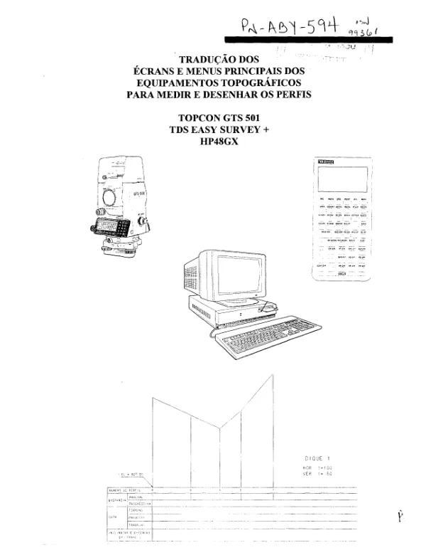
TRADUÇÃO DOS ÉCRANS E MENUS PRINCIPAIS DOS EQUIPAMENTOS TOPOGRÁFICOS PARA MEDIR E DESENHAR OS PERFIS
Sign inUSAID DEC
TRADUÇÃO DOS ÉCRANS E MENUS PRINCIPAIS DOS EQUIPAMENTOS TOPOGRÁFICOS PARA MEDIR E DESENHAR OS PERFIS
The TOPCON GTS-501 electronic total station is a precision instrument used for topographic surveys and mapping.
2009 · 65 pages
Sign in to readA free account is required to download.
Abstract
The device features a range of modes and functions, including the "Std" mode, which is used for standard measurements. In the "Std" mode, the instrument has a range of symbols and functions that can be accessed through various buttons on the screen. The symbols include OSET, HD, HOLD, HSET, MEAN, MEAS, MODE, m/fi, NEZ, PI, P2, RJL, SA, SD, SET, SO, TILT, VH, and V/%. Each symbol corresponds to a specific function, such as measuring distance, angle, or height. The instrument also features a "Prog" mode, which is used for programming and setting up the device. In this mode, the user can access various functions, including setting the direction angle, setting the point, and storing the data. The "Prog" mode has a range of symbols and functions, including BS, COMPLETE, EXIT, HR, INP, LAYOUT, LINE, MLM, MORE, M-POINT, NO, REM, REP, SET OK?, STORE, T-POINT, and YES. Each symbol corresponds to a specific function, such as setting the direction angle, storing the data, or exiting the mode. The TOPCON GTS-501 also features a range of other modes and functions, including the "MEAS" mode, which is used for measuring distances and angles, and the "TILT" mode, which is used for measuring the tilt of the instrument. The instrument is designed for use in a variety of applications, including topographic surveys, mapping, and construction. It is a precision instrument that requires careful calibration and setup to ensure accurate measurements. The device is manufactured by TOPCON America Corporation, and is designed to meet the needs of professionals in the field of surveying and mapping. It is a high-precision instrument that is capable of making accurate measurements in a variety of environments. The instrument has a range of features, including a high-resolution display screen, a range of measurement modes, and a built-in calculator. It is also designed to be easy to use, with a range of intuitive menus and functions that make it simple to navigate and use. The TOPCON GTS-501 is a high-quality instrument that is designed to meet the needs of professionals in the field of surveying and mapping. It is a precision instrument that requires careful calibration and setup to ensure accurate measurements, but it is a valuable tool for anyone working in this field. The instrument is designed to be used in a variety of environments, including construction sites, surveying offices, and mapping laboratories. It is a high-precision instrument that is capable of making accurate measurements in a variety of conditions, and it is a valuable tool for anyone working in the field of surveying and mapping. The instrument is designed to be used in a variety of environments, including construction sites, surveying offices, and mapping laboratories. It is a high-precision instrument that is capable of making accurate measurements in a variety of
Related documents