ICRC
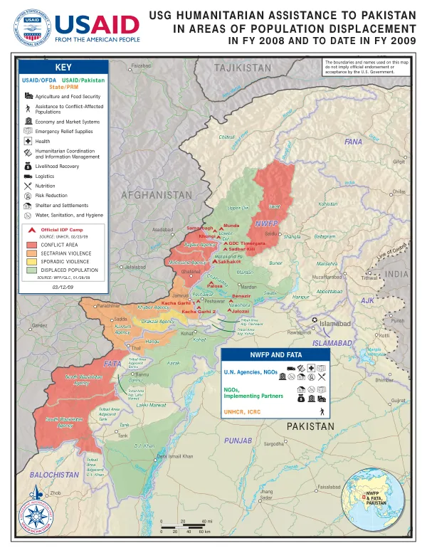
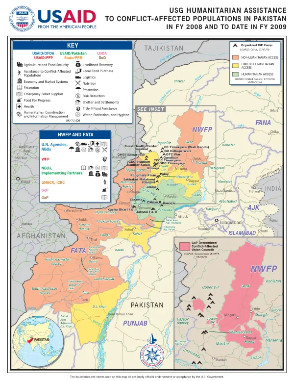
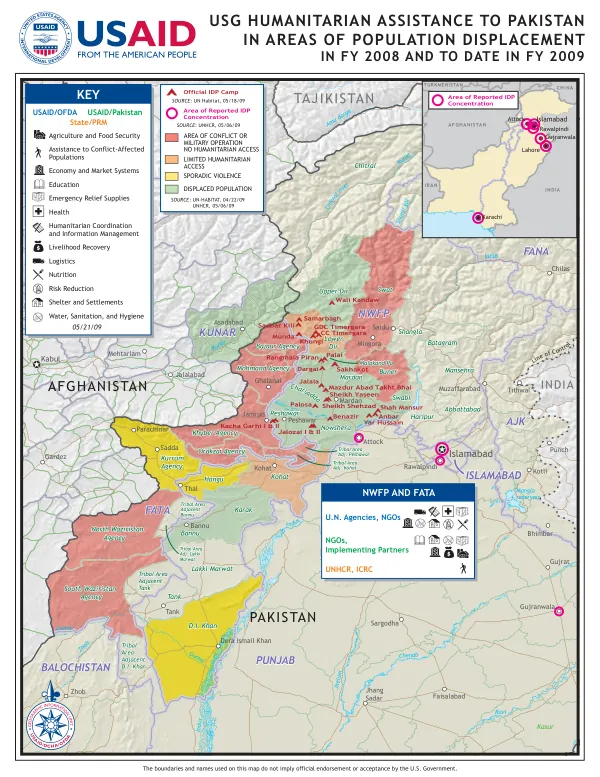
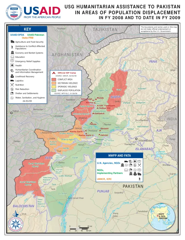
USG HUMANITARIAN ASSISTANCE TO PAKISTAN IN AREAS OF POPULATION DISPLACEMENT
The Khyber Pakhtunkhwa (KP) and Federally Administered Tribal Areas (FATA) region of Pakistan is characterized by a complex geography, with numerous mountain ranges, valleys, and rivers.
2009 · 1 pages
Sign in to readA free account is required to download.
Abstract
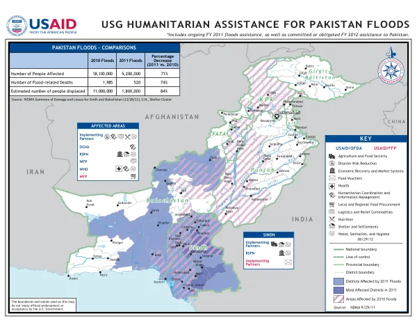
The region includes the provinces of Khyber Pakhtunkhwa, FATA, and the Federally Administered Northern Areas (FANA). The administrative divisions of KP and FATA comprise 10 agencies, 7 districts, and 2 tribal areas. The region shares borders with Afghanistan to the west, Tajikistan to the north, and India to the east. The region's geography is marked by the presence of several major rivers, including the Indus, Kabul, and Kunar rivers. The Indus River forms the western boundary of KP and FATA, while the Kabul River flows through the region and joins the Indus River near the city of Peshawar. The Kunar River originates in the eastern part of the region and flows into Afghanistan. The region's terrain is also characterized by numerous mountain ranges, including the Hindu Kush, Karakoram, and Himalayan ranges. The administrative divisions of KP and FATA include the following agencies: Bajaur Agency, Mohmand Agency, Khyber Agency, Orakzai Agency, North Waziristan Agency, South Waziristan Agency, and Kurram Agency. The region also comprises 7 districts, including Peshawar, Charsadda, Nowshera, Mardan, Swabi, Haripur, and Abbottabad. The two tribal areas are the Federally Administered Tribal Areas (FATA) and the Federally Administered Northern Areas (FANA). The region has a complex history, with various empires and dynasties having ruled over it in the past. The region has also been a hub of trade and commerce, with the ancient Silk Road passing through it. Today, the region is home to a diverse population of over 30 million people, with various ethnic and linguistic groups residing in the area. The region has also been affected by conflict and instability in recent years, with various militant groups operating in the area. The region's economy is primarily based on agriculture, with crops such as wheat, rice, and maize being major contributors to the region's GDP. The region is also rich in natural resources, including minerals such as coal, iron, and copper. The region's infrastructure is also being developed, with various roads, bridges, and other projects being undertaken to improve connectivity and access to the region. The region has received significant humanitarian assistance in recent years, with various international organizations and governments providing aid to the affected populations. The United States Agency for International Development (USAID) has been a major provider of humanitarian assistance to the region, with programs focused on agriculture and food security, assistance to conflict-affected populations, economy and market systems, education, emergency relief supplies, health, humanitarian coordination and information management, livelihood recovery, logistics, nutrition, risk reduction, shelter and settlements, and water, sanitation, and hygiene.
Related documents