ICRC
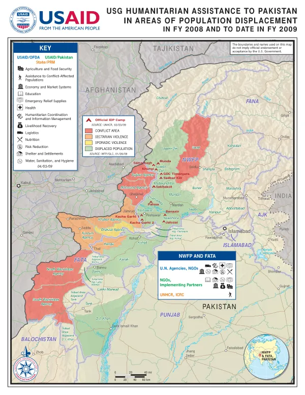
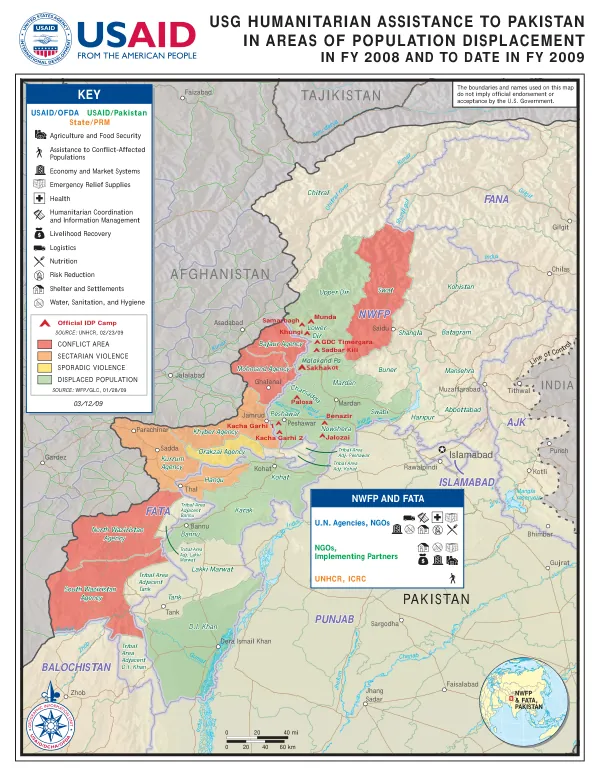
USG HUMANITARIAN ASSISTANCE TO PAKISTAN IN AREAS OF POPULATION DISPLACEMENT
The Khyber Pakhtunkhwa (KP) and Federally Administered Tribal Areas (FATA) region of Pakistan is characterized by a complex geography, with numerous mountain ranges, valleys, and rivers.
2009 · 1 pages
Sign in to readA free account is required to download.
Abstract
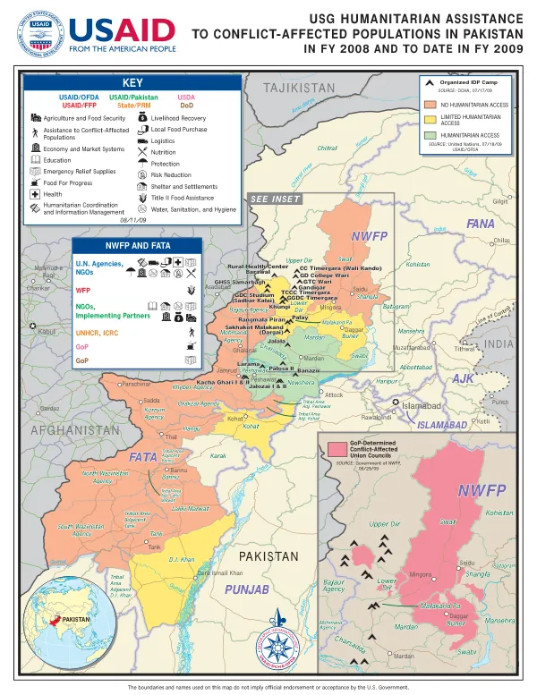
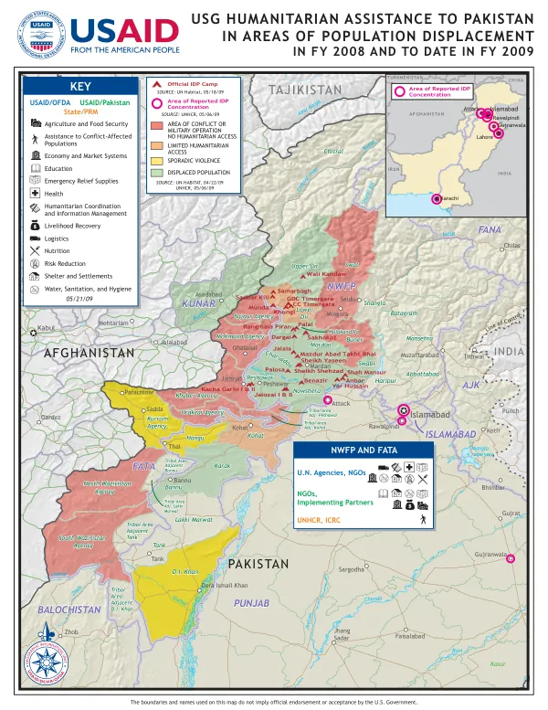
The region includes the provinces of Khyber Pakhtunkhwa, FATA, and the Federally Administered Northern Areas (FANA). The KP region is bounded by the provinces of Punjab to the east, Balochistan to the west, and the Federally Administered Tribal Areas to the north. The region is also bordered by Afghanistan to the northwest and India to the east. The region's terrain is diverse, with the Himalayan mountain range stretching across the north, the Karakoram range in the northeast, and the Sulaiman range in the southwest. The region is also home to several major rivers, including the Indus, Jhelum, Chenab, and Ravi. The Indus River is the longest river in Pakistan and flows through the KP region, providing water and fertile soil for agriculture. The region is divided into several administrative divisions, including the Malakand Division, Hazara Division, and Peshawar Division. The Malakand Division includes the districts of Chitral, Dir, Shangla, and Buner, while the Hazara Division includes the districts of Mansehra, Abbottabad, and Haripur. The Peshawar Division includes the districts of Peshawar, Nowshera, and Mardan. The region has a long history of conflict, with various ethnic and sectarian groups vying for power and influence. The region has been affected by sectarian violence, sporadic violence, and displacement of populations. The conflict has resulted in the displacement of thousands of people, with many living in official IDP camps or in informal settlements. The region is also home to several major cities, including Peshawar, Mardan, and Abbottabad. The cities are hubs for trade, commerce, and industry, and are connected to the rest of the country by a network of roads, railways, and airways. The region is also home to several major military installations, including the Khyber Agency and the Orakzai Agency. The region is supported by various international organizations, including the United Nations High Commissioner for Refugees (UNHCR), the International Committee of the Red Cross (ICRC), and the World Food Programme (WFP). The organizations provide humanitarian assistance, including food, shelter, and medical care, to affected populations. The United States Agency for International Development (USAID) also provides humanitarian assistance to the region, including emergency relief supplies, shelter, and water, sanitation, and hygiene (WASH) services. The region's economy is primarily based on agriculture, with crops such as wheat, maize, and rice being major contributors to the region's GDP. The region is also home to several major industries, including textiles, food processing, and construction. The region's economy is also supported by remittances from overseas workers, who send money back to their families in the region. The region's population is diverse, with several ethnic and sectarian groups living in the region. The population is primarily Muslim, with several major sects, including Sunni and Shia Muslims. The region is also home to several minority groups, including Christians, Hindus, and Sikhs. The region's infrastructure is underdeveloped, with many roads, bridges, and buildings in need of repair or replacement. The region's healthcare system is also underdeveloped, with many hospitals and clinics in need of equipment and staff. The region's education system is also underdeveloped, with many schools and universities in need of resources and infrastructure. The region's future is uncertain, with ongoing conflict and displacement affecting the lives of thousands of people. The region requires significant investment in infrastructure, healthcare, and education to support the growth and development of the population. The region also requires support from international organizations and donors to address the humanitarian needs of affected populations.
Related documents