USAID DEC
Análisis de conectividad para bosque seco en una zona del Caribe colombiano
The analysis of connectivity for dry forest in a region of the Colombian Caribbean was conducted in August 2014.
2014 · 13 pages
Sign in to readA free account is required to download.
Abstract
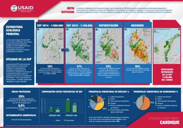
The study involved a regional exercise in coarse connectivity corridors, with a focus on five zones of high detail: Atlántico – Bolívar, Montes de María, Rio Gaira – Ciénaga Magdalena, Rio Seco - Cesar, and Rio Garupal - Cesar. These zones were prioritized based on various factors, including petroleum interests, mining interests, road infrastructure, regional and local conservation processes, and potential societies for the establishment of corridors. The Montes de María case study involved the interpretation of land cover data at a scale of 1:100,000 using Landsat satellite images from December 2013, along with the identification of corridors using the methodology of surface resistance and minimum cost routes. The land cover data from 2014 revealed a range of categories, including forests, areas with herbaceous and/or shrub vegetation, permanent crops, transitory crops, pastures, and areas with mixed agriculture. The analysis of connectivity corridors involved the assignment of resistances to the matrix around patches of dry forest, using a heuristic expert method. The resistances were categorized into various levels, ranging from 1 to 1,000, and were used to calculate the costs of connectivity. The costs were determined through algebraic mapping between the resistances of the matrix and the distance of each point to the nearest patch. The results showed a range of costs, from 0 to 500,000, with the majority of values falling within the range of 10,000 to 100,000. The analysis also considered various factors that could affect connectivity, including roads, mining activities, and land cover changes. The results of the analysis were presented in the form of maps and tables, which showed the resistances and costs associated with connectivity corridors in the study area. The study aimed to provide a comprehensive understanding of the connectivity of dry forest in the region and to inform conservation and management efforts.
Related documents