USAID DEC
Modelacion sobre escenarios e impactos hidrologicos Cuenca del Rio Hacha
The Cuenca del Rio Hacha is a hydrological basin located in the municipality of Florencia, department of Caquetá, Colombia.
2016 · 54 pages
Sign in to readA free account is required to download.
Abstract
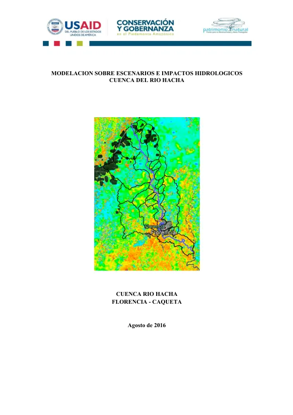
The basin is situated in the noroccidental sector of the municipality, within the cordillera oriental and altiplanicie amazónica, with a maximum height of 2,575 meters above sea level and a minimum height of 240 meters. The basin is part of two national protection zones: the Reserva Forestal de la Amazonia and the Distrito de Conservación de Suelos y Aguas del Caquetá. The basin has a total area of 49,018 hectares, with 21.4% of the area corresponding to the municipality of Florencia. The Rio Hacha originates in the Reserva Forestal de la Amazonia at an approximate height of 2,400 meters above sea level and flows into the Rio Orteguaza. The basin's course runs from noroeste to suroeste, with several tributaries, including the Rio Caraño, Quebrada La Marola, and Quebrada La Ruidosa. The basin's limits are defined as follows: to the north, the crest of the cordillera Oriental serves as the boundary with the Cuenca del Río Suaza (department of Huila); to the east, the boundary is with the Cuenca del Río Orteguaza; to the south, the boundary is with the Cuenca del Río Bodoquero; and to the west, the boundary is with the Cuenca del Río Bodoquero. According to the Plan de Ordenamiento y Manejo de la Cuenca (POMCA 2006-2025), the entire rural surface of the basin is protected by some type of environmental figure, including the Reserva Forestal de la Amazonia. This area is part of the Reserva Forestal de la Amazonia, declared by Law 2 of 1959, and is subject to the sustracción made by the Acuerdo 020 of 1974 of the INDERNA, which created the Distrito de Conservación de Suelos y Aguas del Caquetá. The basin's precipitation is characterized by a rainy season from April to November, with an average annual rainfall of 2,500 mm. The precipitation is influenced by the basin's location in the Amazon rainforest, with a high level of rainfall throughout the year. The basin's hydrological regime is characterized by a high level of runoff, with a discharge of 10.5 m3/s at the basin's outlet. The basin's water quality is influenced by the presence of several tributaries, including the Rio Caraño and Quebrada La Marola, which contribute to the basin's water flow. The basin's water quality is also influenced by the presence of agricultural activities, including the cultivation of crops such as coffee and cacao, which can contribute to the basin's water pollution. The basin's hydrological modeling was conducted using the AquaAndes program, which provides a hydrological baseline for understanding the basin's hydrological variables. The model was used to simulate several scenarios, including the loss of herbaceous cover and the loss of forest cover, as well as the increase in forest cover and the increase in herbaceous cover. The results of the model simulations indicate that the basin's hydrological regime is sensitive to changes in land use and land cover, with significant impacts on the basin's water flow and water quality. The basin's management is critical to maintaining the basin's hydrological regime and water quality. The basin's management should focus on maintaining the basin's forest cover and preventing the loss of herbaceous cover. The basin's management should also focus on reducing the impact of agricultural activities on the basin's water quality. The basin's management should also consider the implementation of measures to reduce the basin's vulnerability to climate change, including the implementation of measures to reduce the basin's flood risk and to improve the basin's water quality.