USAID DEC
Rapid Assessment of Shoreline Characteristics and Dynamics of the Lazy Lagoon at Mlingotini Village, Bagamoyo
Sign inCOASTAL RESOURCES CENTER OF THE UNIVERSITY OF RHODE ISLAND
Rapid Assessment of Shoreline Characteristics and Dynamics of the Lazy Lagoon at Mlingotini Village, Bagamoyo
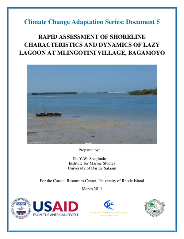
The Lazy Lagoon is a northwesterly trending lagoon located along the coast of Tanzania Mainland, approximately 10 km south of Bagamoyo Town and 60 km north of Dar es Salaam City.
2011 · 39 pages
Sign in to readA free account is required to download.
Abstract
The lagoon is roughly rectangular with an area of approximately 15 km2 during high Spring tides. The landward side of the Lagoon extends for some 10 km between Mlingotini village located to the south and the Mbegani Fishery Station located to the north. The seaward side of the Lagoon is bounded by a narrow (<50m width) raised Pleistocene reef platform. The lagoon is connected to the Indian Ocean through its northern end and a tidal creek located on the eastern side of the Lagoon proximal to Mlingotini. The Lagoon is characterized by several other patchily distributed raised reef Pleistocene platforms, mangrove forests, and dense mangrove thickets. The mangrove forests occur as one of the most prominent features within the Lagoon, with relatively denser thickets at Mbegani and Mlingotini. An oceanographic and geological field work was conducted at Lazy Lagoon area in January/February 2011 for the purpose of making a rapid assessment of the shoreline characteristics and the dynamics of the Lagoon. The field data used for the present study consisted of echo sounding data, sediment samples, tidal currents, and tidal elevation measurements, as well as field mapping of relevant physical features. The echo sounding data was collected along short cross-shore transects running from the landward side towards the raised reef platforms during high spring tides from 17-19th January 2011. The echo sounding measurements were conducted aboard a small fishing boat using a hand-held echo sounder, with positioning (depth “fixes”) taken using a hand-held GPS. The depth, positions, and time were simultaneously recorded in a Field logbook for further processing. The tidal elevation data used for the correction of the depth data were obtained from the pressure measurements. An analysis of the echo sounding data was undertaken using Surfer computer software. Prior to contouring operation, the program required that grid files be created from the original X, Y, Z data points, where X, Y, and Z represent the geographic coordinates and depth respectively. The grid files were created using Kriging method (Keckler, 1995) with a linear variogram. The sediment samples were collected from various locations within the Lagoon, and the location of the sediment sampling sites is shown in Figure 3. The sediment composition, grain size distribution, and tidal currents were analyzed to understand the dynamics of the Lagoon. The results of the analysis are presented in the following sections. The sediment composition of the Lagoon was analyzed to determine the type and distribution of sediments present. The results showed that the sediments in the Lagoon are primarily composed of sand, silt, and clay. The grain size distribution of the sediments was also analyzed to determine the size and distribution of the sediment particles. The results showed that the sediments in the Lagoon are primarily composed of fine to medium-grained sand. The tidal currents in the Lagoon were analyzed to determine the direction and speed of the tidal currents. The results showed that the tidal currents in the Lagoon are primarily driven by the tidal forces, with the currents flowing in a north-south direction. The tidal elevation measurements were also analyzed to determine the amplitude and phase of the tidal cycles. The results showed that the tidal cycles in the Lagoon are primarily driven by the gravitational forces of the moon and sun. The status of coastal erosion and coastal vulnerability to erosion was also analyzed to determine the potential impacts of coastal erosion on the Lagoon. The results showed that the Lagoon is vulnerable to coastal erosion, with the erosion rates increasing over time. The recommendations for mitigating the impacts of coastal erosion on the Lagoon are presented in the following section. The conclusions of the study are presented in the following section. The study provides a comprehensive understanding of the shoreline characteristics and dynamics of the Lazy Lagoon. The results of the study can be used to inform management decisions and conservation efforts for the Lagoon.
Related documents