TETRA TECH
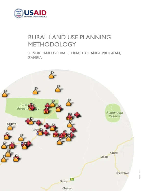
Rural Land Use Planning Methodology
Land use planning in Zambia's customary areas is a complex process that aims to consolidate information on the status of land use and land information to inform sustainable, socially compatible, and environmentally sound land use options.
2017 · 40 pages
Sign in to readA free account is required to download.
Abstract
The methodology for this process was developed based on past USAID land use planning efforts and anticipates using a combination of primary and secondary data collection methods. The process involves stakeholder engagement with traditional leaders, advisors, and community members, as well as use of spatial information to facilitate dialogue and decision-making and allocate resources. The objectives of land use planning in Zambia's customary areas are to consolidate information on the status of land use and land information, inform land use options that are sustainable, socially compatible, and environmentally sound, and mitigate social and environmental challenges facing Zambia's rural areas. Chiefs have a significant amount of autonomy in land management in their chiefdoms, but also rely heavily on the government for services such as schools, roads, agricultural investment, and water infrastructure. Spatially accurate information on current land use and development patterns is necessary to inform rational decisions on government services, internal community activities, and outside investment. The challenge of documenting the current status of customary and state land and associated resources in Zambia's rural areas is immense, and is the focus of the government's ongoing Land Audit. This includes understanding the land management regime and current limitations within that regime. The rural landscape in Zambia is vast, and the viability of different investments varies. Rural livelihoods are not dependent on a single revenue source, such as agriculture, but rather on a diverse range of activities. The methodology for land use planning in Zambia's customary areas involves a range of data collection methods, including basic surveys that can cover five to ten villages in a day, and intensive multi-day visits to hundreds of villages. Stakeholder engagement is required with traditional leaders, advisors, and community members, as well as use of spatial information to facilitate dialogue and decision-making and allocate resources. The use of spatial information is at the heart of this methodology, and is expected to reveal long-standing tensions in development, such as between communities and government over resource management, or between communities and leaders over land allocation decisions. The land use planning process in Zambia's customary areas is expected to result in the development of ambitious but realistic land use and development plans that take into account the needs and priorities of local communities. The plans are expected to be informed by spatially accurate information on current land use and development patterns, and to provide a framework for decision-making on government services, internal community activities, and outside investment. The plans are also expected to mitigate social and environmental challenges facing Zambia's rural areas, and to promote sustainable, socially compatible, and environmentally sound land use options. The methodology for land use planning in Zambia's customary areas is expected to be used by traditional chiefs, government planners, and other stakeholders to inform land use planning decisions. The methodology is expected to be adapted to different levels of data collection, from basic surveys to intensive multi-day visits to hundreds of villages. The use of spatial information is expected to facilitate dialogue and decision-making and allocate resources, and to reveal long-standing tensions in development.