USAID DEC
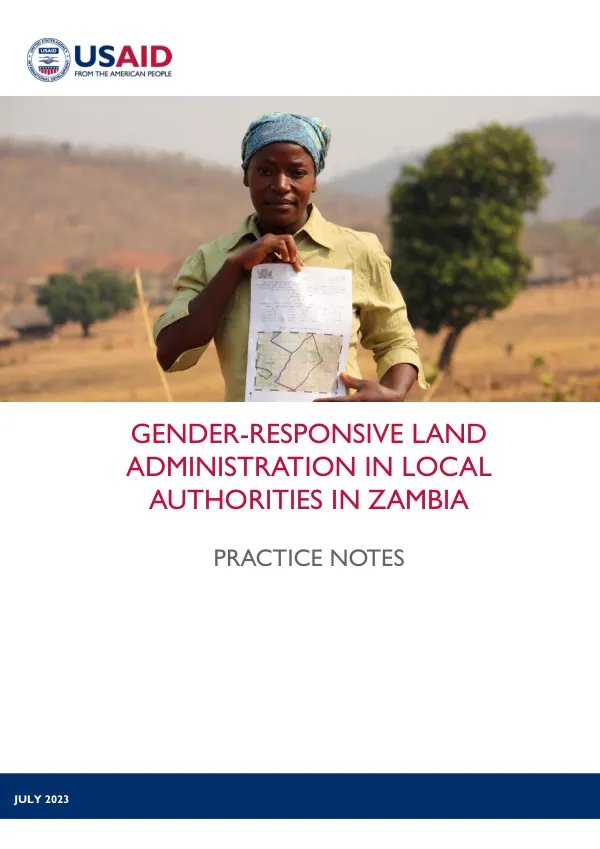
Gender-Responsive Land Administration in Local Authorities in Zambia: Practice Notes
Sign inTETRA TECH
Gender-Responsive Land Administration in Local Authorities in Zambia: Practice Notes
Land administration in local authorities in Zambia is a complex process that involves various stakeholders, including government institutions, community members, and individuals.
2023 · 60 pages
Sign in to readA free account is required to download.
Abstract
The process is governed by the legal and policy framework, which is outlined in the Land Alienation System in Zambia Fact Sheet. This framework provides a comprehensive overview of the land administration process, including the roles and responsibilities of various stakeholders. The land administration process in Zambia is characterized by a mix of customary and statutory land tenure systems. Customary land is held by communities and individuals, while statutory land is held by the government. The process of accessing customary land involves institutional and individual processes, including the submission of applications and the payment of fees. However, the conversion of customary land to statutory land is a complex process that involves various stakeholders, including government officials, community members, and individuals. Gender equality and women's land rights are critical components of land administration in Zambia. The Zambian law provides for equal rights to land for women and men, but in practice, women face various barriers to accessing and owning land. These barriers include lack of awareness, lack of access to information, and lack of support from government officials and community members. To promote inclusive land rights, local authorities can take various actions, including providing education and awareness programs, supporting women's participation in land decision-making, and promoting gender-sensitive land policies. Best practices in land identification involve the use of Geographic Information Systems (GIS) to identify and map land parcels. This process helps to ensure that land is allocated fairly and efficiently. However, the land identification process is often plagued by gaps, including lack of data, lack of coordination among stakeholders, and lack of transparency. To address these gaps, best practices in land identification involve the use of participatory approaches, including public consultations, community engagement, and stakeholder participation. Best practices in planning survey and issues report involve the use of participatory approaches, including public consultations, community engagement, and stakeholder participation. This process helps to ensure that land is allocated fairly and efficiently, and that the needs of various stakeholders are taken into account. However, the planning survey and issues report process is often plagued by gaps, including lack of data, lack of coordination among stakeholders, and lack of transparency. To address these gaps, best practices in planning survey and issues report involve the use of GIS, the use of participatory approaches, and the provision of education and awareness programs. Best practices in layout plan preparation involve the use of GIS to identify and map land parcels. This process helps to ensure that land is allocated fairly and efficiently. However, the layout plan preparation process is often plagued by gaps, including lack of data, lack of coordination among stakeholders, and lack of transparency. To address these gaps, best practices in layout plan preparation involve the use of participatory approaches, including public consultations, community engagement, and stakeholder participation. Best practices in budgeting and implementation involve the use of participatory approaches, including public consultations, community engagement, and stakeholder participation. This process helps to ensure that land is allocated fairly and efficiently, and that the needs of various stakeholders are taken into account. However, the budgeting and implementation process is often plagued by gaps, including lack of data, lack of coordination among stakeholders, and lack of transparency. To address these gaps, best practices in budgeting and implementation involve the use of GIS, the use of participatory approaches, and the provision of education and awareness programs. Best practices in land allocation involve the use of participatory approaches, including public consultations, community engagement, and stakeholder participation. This process helps to ensure that land is allocated fairly and efficiently, and that the needs of various stakeholders are taken into account. However, the land allocation process is often plagued by gaps, including lack of data, lack of coordination among stakeholders, and lack of transparency. To address these gaps, best practices in land allocation involve the use of GIS, the use of participatory approaches, and the provision of education and awareness programs. The use of Geographic Information Systems (GIS) is a critical component of land administration in Zambia. GIS helps to identify and map land parcels, and to track land ownership and tenure. However, the use of GIS are often plagued by gaps, including lack of data, lack of coordination among stakeholders, and lack of transparency. To address these gaps, best practices in GIS involve the use of participatory approaches, including public consultations, community engagement, and stakeholder participation. In conclusion, land administration in local authorities in Zambia is a complex process that involves various stakeholders, including government institutions, community members, and individuals. The process is governed by the legal and policy framework, which is outlined in the Land Alienation System in Zambia Fact Sheet. To promote inclusive land rights, local authorities can take various actions, including providing education and awareness programs, supporting women's participation in land decision-making, and promoting gender-sensitive land policies.
Related documents