NASA
SERVIR: Connecting Space to Village
Extreme events such as fire, flood, drought, and storms can have devastating impacts on regions worldwide.
2015 · 2 pages
Sign in to readA free account is required to download.
Abstract
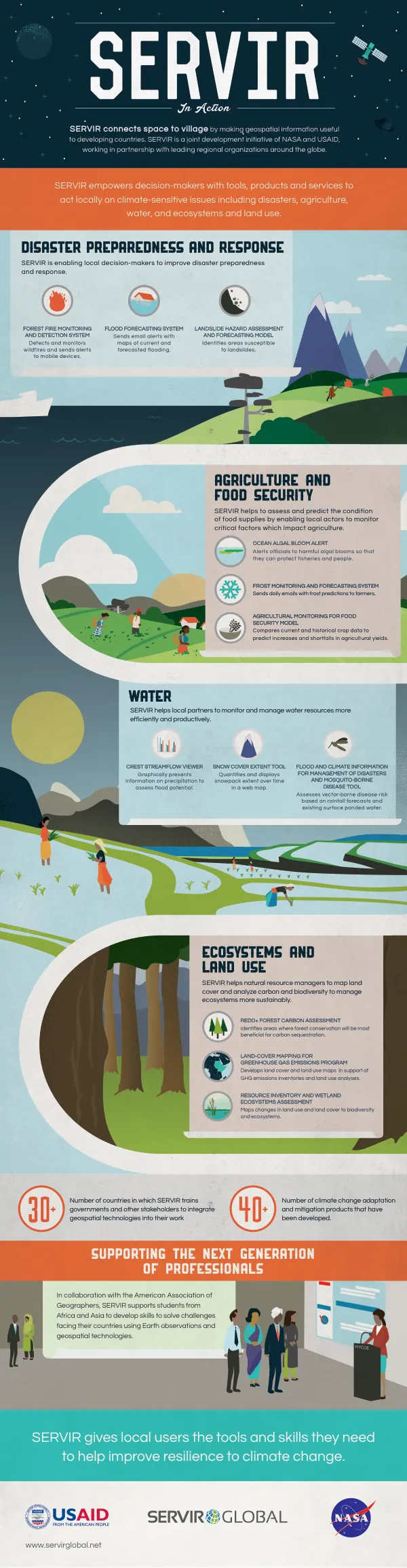
SERVIR's global partners collaborate with local officials to reduce risks associated with these events by monitoring conditions, creating early-warning systems, preparing for eventualities, and visualizing damage when it occurs to speed response. SERVIR connects space to village by making geospatial information, including Earth observation data from satellites, Geographic Information Systems, and predictive models, useful to developing countries. This initiative is a joint development project of NASA and USAID, working in partnership with leading regional organizations around the globe. SERVIR helps those most in need of tools for managing climate risks and land use. SERVIR global hubs include SERVIR-Eastern and Southern Africa, hosted by the Regional Centre for Mapping of Resources for Development (RCMRD), SERVIR-Himalaya, hosted by the International Centre for Integrated Mountain Development (ICIMOD), and SERVIR-Mekong, hosted by the Asian Disaster Preparedness Center (ADPC). Launched in October 2014, SERVIR places science in the service of society by building the technical capacities of regional organizations with an established track record of working with governments and communities to apply geospatial tools at the local and regional levels. Through the SERVIR network, experts at SERVIR regional hubs partner with local decision-makers and local and US-based scientists to create new datasets, maps, and decision-support tools that answer critical development questions. SERVIR hubs also provide training to build capacity in local institutions for evidence-based decision-making to meet societal needs. Managing extreme events is a key focus area for SERVIR, with a particular emphasis on forecasting floods. SERVIR works with water resource managers at the river basin level to address risk management, vulnerability mapping, preparedness, conservation, and flood forecasting. The Coupled Routing and Excess Storage Tool (CREST) is a sophisticated hydrologic modeling tool that integrates satellite rainfall information with land shape, elevation, soil characteristics, and other variables to calculate actual evaporation, transpiration, soil moisture, and streamflow. In eastern Africa, CREST covers watersheds with data from 850 stream gauge locations and enables water managers to assess imminent and near-term likelihood of flooding at selected locations. In Kenya, the Department of Water Resources requested high-resolution maps of areas inundated as a result of flooding. In response, RCMRD's analysts created a mapping application to visualize the extent of flood damage. A SERVIR project is developing capabilities to monitor water resources availability in Tanzania, Ethiopia, and Zambia, and provide near-term streamflow forecasts in support of regional water resource management. This project will also develop a quantitative assessment of how climate change impacts these nations' water resources.
Related documents