FAO
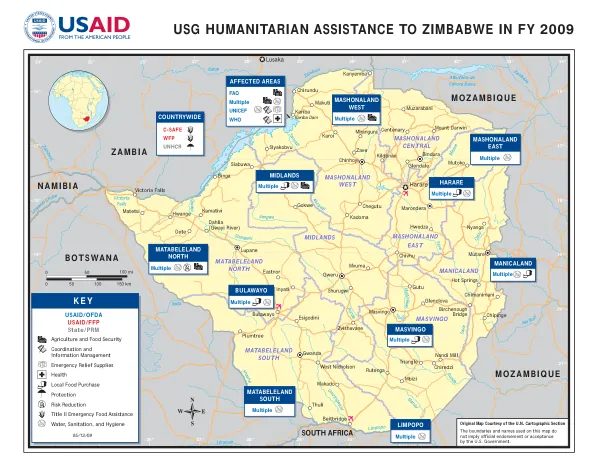
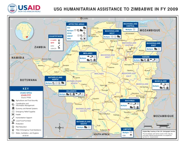
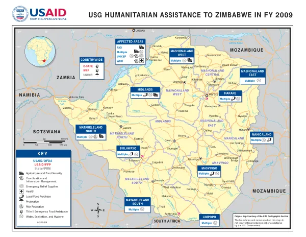
USG HUMANITARIAN ASSISTANCE TO ZIMBABWE IN FY 2009
Temperature fluctuations ranged from 16° to 34°, with significant variations in different regions.
2009 · 1 pages
Sign in to readA free account is required to download.
Abstract
The geographic focus of the initiative included provinces such as Midlands, Masvingo, Matabeleland North, and Mashonaland West. The Kariba Dam, located on the border with Zambia, played a significant role in the region's agricultural development. The initiative also addressed food security, with a focus on emergency relief supplies and local food purchase. The initiative also involved coordination and information management, with multiple stakeholders including USAID, WFP, UNHCR, and FAO contributing to the effort. The affected areas included Bulawayo, Manicaland, Midlands, and Matabeleland North, among others.
Connected topics