ADRA
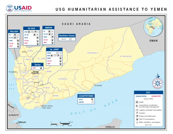
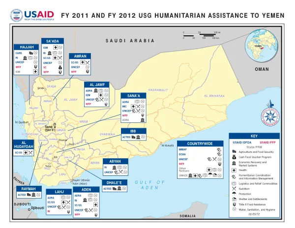
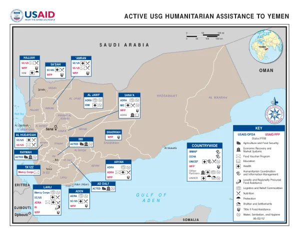
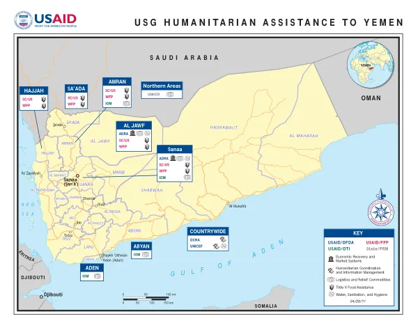
DCHA/OFDA Yemen Complex Program Map
Yemen's geographic regions include Ta'izz, Dhamar, Rida', Ibb, Shaykh 'Uthman, Aden (Adan), Al Mukalla, Sa'ada, Az Zaydiyah, and Djibouti.
2011 · 1 pages
Sign in to readA free account is required to download.
Abstract
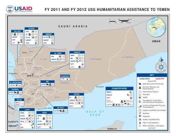
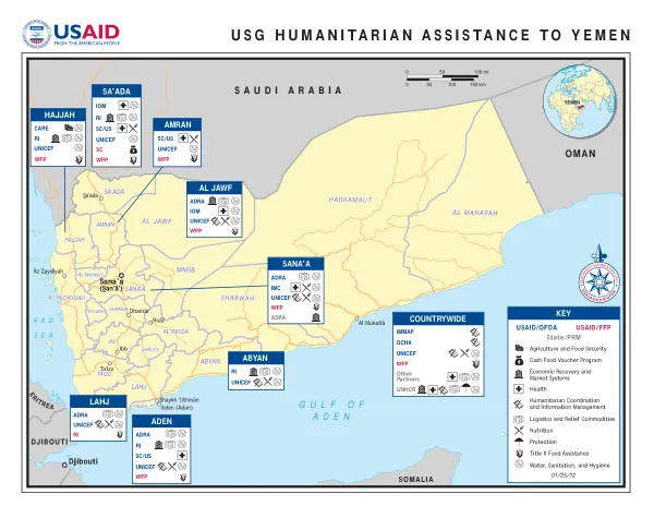
Sanaa (San'a') is a significant urban center, while HADRAMAUT, AL MAHARAH, AL JAWF, SHABWAH, MARIB, LAHJ, ABYAN, and TAIZZ are also notable regions. SA'ADA, HAJJAH, AMRAN, AL BAYDA, and DHAMAR are other key areas. The map highlights Yemen's proximity to neighboring countries, including Saudi Arabia, Oman, Somalia, and Djibouti. The Red Sea borders Yemen to the west, with the Arabian Peninsula to the east. The country's terrain is characterized by a mix of desert and mountainous regions, with various geographic features such as the Red Sea and the Arabian Peninsula. The map also indicates the presence of various humanitarian organizations, including USAID/OFDA, USAID/FFP, USAID/OTI, State/PRM, OCHA, UNICEF, and UNHCR. These organizations are involved in various sectors, including Economic Recovery and Market Systems, Humanitarian Coordination and Information Management, Logistics and Relief Commodities, and Title II Food Assistance. The map's key highlights the involvement of various organizations in Yemen, including USAID/OFDA, USAID/FFP, USAID/OTI, State/PRM, OCHA, UNICEF, and UNHCR. The map also indicates the presence of various sectors, including Economic Recovery and Market Systems, Humanitarian Coordination and Information Management, Logistics and Relief Commodities, and Title II Food Assistance. The map's legend includes various acronyms, such as USAID, OFDA, FFP, OTI, PRM, OCHA, UNICEF, and UNHCR, which represent different humanitarian organizations and sectors. The map's scale is indicated by the presence of various geographic features, including the Red Sea and the Arabian Peninsula, as well as the country's borders with neighboring countries.