CHEMONICS
Estructura Ecológica Principal para la jurisdicción de CARSUCRE
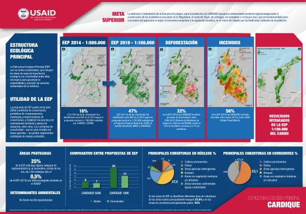
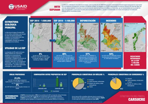
The Estructura Ecológica Principal (EEP) for the CARSUCRE jurisdiction aims to support regional territorial ordering by conserving ecosystems such as the Montes de María, mangroves in the Golfo de Morrosquillo, and areas influenced by the Canal del Dique.
2020 · 1 pages
Sign in to readA free account is required to download.
Abstract
These ecosystems are crucial for water provision, soil recovery, and biodiversity support, while respecting local communities' cultural traditions. The EEP is composed of environmental assets, including areas of special ecological importance and connectivity between them, necessary to ensure the sustainability and provision of environmental services in a territory. The EEP can be used to define conservation portfolios, compensation portfolios, and complementary conservation strategies, as well as to strengthen territorial ordering and development planning processes. The EEP 2019-1:100,000 and EEP 2014-1:500,000 maps show the extent of the EEP in the CARSUCRE jurisdiction. The EEP 2019-1:100,000 map indicates that 21.5% of the EEP is under some form of regulation, but only 3% are protected areas included in the RUNAP. The main coverages in núcleos and corredores are primarily cultivos and áreas heterogéneas, and pastos, respectively. The EEP has identified different types of coverages in the núcleos and corredores. In the núcleos, primarily cultivos and áreas heterogéneas cover 38.5%, while in the corredores, primarily pastos cover 84%. The 43.7% of the núcleos and 13% of the corredores of the EEP correspond to Áreas Prioritarias para la Conservación (AAP), designated by the Corporación as a determinant environmental factor. The 44.3% of the núcleos and 81% of the corredores of the EEP correspond to areas for agricultural, livestock, and natural resource production (APAG) of the corporación. The EEP 2019-1:100,000 map also shows that 57% of the EEP in CARSUCRE has had deforestation processes between 1990-2018, with 50% occurring in núcleos and 7% in corredores. Additionally, 64% of the EEP in CARSUCRE has had fires between March 2019 and March 2020, according to the Global Forest Watch. The EEP is a crucial tool for conservation and sustainable development in the CARSUCRE jurisdiction. By identifying areas of special ecological importance and connectivity, the EEP can help to ensure the sustainability and provision of environmental services in the territory. The EEP can also be used to define conservation portfolios, compensation portfolios, and complementary conservation strategies, as well as to strengthen territorial ordering and development planning processes. The EEP 2019-1:100,000 map shows that the main coverages in núcleos and corredores are primarily cultivos and áreas heterogéneas, and pastos, respectively. The EEP has identified different types of coverages in the núcleos and corredores, with primarily cultivos and áreas heterogéneas covering 38.5% of the núcleos and primarily pastos covering 84% of the corredores.