USAID DEC
HRH2030 Capacity Building for Malaria Activity Quarterly Report (July-September 2019)
Sign inNATIONAL MALARIA CONTROL PROGRAM
HRH2030 Capacity Building for Malaria Activity Quarterly Report (July-September 2019)
The Gambian National Malaria Control Program (NMCP) aims to reach malaria pre-elimination status, a goal that has been significantly advanced since 2013, when malaria case incidence per 1000 in the Gambia was 130, compared to 34 in 2017.
2019 · 3 pages
Sign in to readA free account is required to download.
Abstract
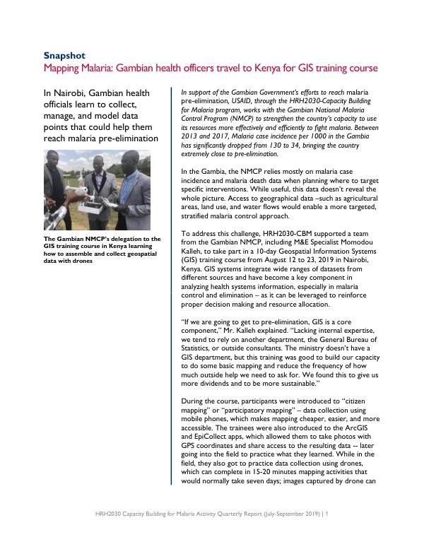
To achieve this goal, the NMCP relies on data-driven decision making, but currently lacks access to geographical data, such as agricultural areas, land use, and water flows, which would enable a more targeted and stratified malaria control approach. To address this challenge, the NMCP, in collaboration with the HRH2030-Capacity Building for Malaria program, supported a team of Gambian health officials to participate in a 10-day Geospatial Information Systems (GIS) training course in Nairobi, Kenya. The training course, which took place from August 12 to 23, 2019, introduced participants to the use of GIS systems, which integrate wide ranges of datasets from different sources and have become a key component in analyzing health systems information, especially in malaria control and elimination. During the course, participants were introduced to "citizen mapping" or "participatory mapping," which involves data collection using mobile phones, making mapping cheaper, easier, and more accessible. The trainees were also familiarized with the ArcGIS and EpiCollect apps, which allow users to collect and share geospatial data, including photos with GPS coordinates. In addition, participants practiced data collection using drones, which can complete mapping activities in 15-20 minutes that would normally take seven days. Since the training, the NMCP has been using the EpiCollect app to collect data points at Indoor Residual Spraying (IRS) sites, creating a map that will inform their reporting to the Global Fund. This map will also allow the NMCP to visualize their data, see the distance between different operational sites, and better plan the next year's IRS campaign. Looking forward, the NMCP hopes to expand mapping high-prevalence areas along the Gambia's borders with Senegal in 2020, to inform cross-border Long-Lasting Insecticide Treated Net (LLIN) distribution campaigns. The Gambian NMCP's M&E Specialist, Momodou Kalleh, emphasized the importance of GIS in achieving malaria pre-elimination status. "If we are going to get to pre-elimination, GIS is a core component," he explained. "Lacking internal expertise, we tend to rely on another department or outside consultants. The ministry doesn't have a GIS department, but this training was good to build our capacity to do some basic mapping and reduce the frequency of how much outside help we need to ask for."
Related documents