USAID DEC
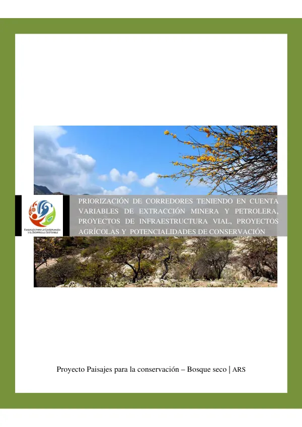
Priorización de Corredores de Conectividad para la Conservación del Bosque Seco Tropical en la Región Caribe
Sign inUSAID
Priorización de Corredores de Conectividad para la Conservación del Bosque Seco Tropical en la Región Caribe
The Programa Paisajes de Conservación, funded by the Agencia de Estados Unidos para el Desarrollo Internacional (USAID), aims to strengthen institutional capacity and governance in protected areas and their adjacent zones to achieve long-term conservation of natural and cultural diversity, while improving the living conditions of communities inhabiting the prioritized geographic areas.
2014 · 20 pages
Sign in to readA free account is required to download.
Abstract
The program has found a significant space for the application of its institutional strengthening and governance components, as well as social capital and community participation, through the platform of the Sistema Regional de Áreas Protegidas (SIRAP). The Bosque seco Tropical (BST) is one of the most threatened ecosystems in the Neotrópico, considering the adverse effects of habitat fragmentation on the system. The promotion of ecological connectivity between fragments is a growing concern within international nature conservation policies, aiming to avoid habitat isolation, slow biodiversity loss, and mitigate the effects of climate change on biota. Integrating connectivity criteria into territorial planning is essential to prevent patches from functioning as isolated areas, incapable of acting as nodes in ecological networks and exercising their conservation role. As part of biodiversity conservation efforts, the Paisajes de Conservación project focuses on maintaining this ecosystem, particularly in the Caribe region. The strategy of connectivity corridors appears to be the most suitable for an highly fragmented and threatened ecosystem. To this end, and as a conservation and restoration strategy, this study aims to identify areas with potential for establishing connectivity corridors between existing BST patches in the Caribe region and highlight areas with higher sectoral pressures. The study is based on geographic information at a 1:100,000 scale, produced and evaluated by the Instituto Alexander Von Humboldt in 2013, and sectoral information from the Agencia Nacional de Hidrocarburos, Agencia Nacional Minera, Agronet, and available road information. The project's objectives are to prioritize connectivity corridors of the remaining BST ecosystem in the Caribe region according to sectoral interests in oil, mining, and infrastructure development. Specific objectives include assigning pressure values to ecosystem activities depending on their state, applying the algebra of maps methodology to identify the overlap of pressures on ecosystems, prioritizing corridors according to identified sectoral pressures, and analyzing conservation scenarios for identified connectivity corridors and their respective pressures. This exercise of prioritizing areas for connectivity through the establishment of corridors only considers the structural component of vegetation cover, excluding functional connectivity. This is a regional-scale analysis and constitutes an approximate guide for the establishment of restoration projects for BST corridors, allowing for their conservation and improvement. In subsequent implementation and development processes, a detailed study at a better temporal and spatial scale will be necessary. The analysis scale and results are at 1:250,000, with cartographic inputs at scales of 1:100,000 and 1:250,000, including BST patches, land use and cover, and topographic base information. The temporal scope of the study is not specified. The study aims to identify areas with potential for establishing connectivity corridors between existing BST patches in the Caribe region and highlight areas with higher sectoral pressures. The methodology involves assigning pressure values to ecosystem activities depending on their state, applying the algebra of maps methodology to identify the overlap of pressures on ecosystems, and prioritizing corridors according to identified sectoral pressures. The study's results are presented in the form of tables and figures, including a calibration of the petrochemical layer, infrastructure, mining, and agro-industry layers, as well as areas affected by extractive activities and pressures on the Caribe region. The study's conclusions highlight the importance of connectivity corridors for the conservation of the BST ecosystem and the need for further analysis and implementation of conservation scenarios for identified corridors. The study's recommendations include the establishment of restoration projects for BST corridors, allowing for their conservation and improvement, and the need for a detailed study at a better temporal and spatial scale to support subsequent implementation and development processes.
Related documents