NASA
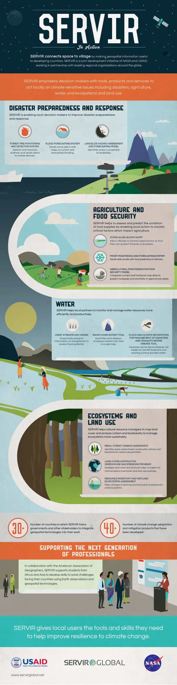
SERVIR: Connecting Space to Village
SERVIR is a joint development initiative of NASA and USAID, working in partnership with leading regional organizations around the globe.
2016 · 1 pages
Sign in to readA free account is required to download.
Abstract
The initiative connects space to village by making geospatial information, including Earth observation data from satellites, Geographic Information Systems, and predictive models, useful to developing countries. SERVIR helps those most in need of tools for managing climate risks and land use. SERVIR global hubs include SERVIR-West Africa, hosted by the Comité permanent Inter-Etats de Lutte contre la Sécheresse dans le Sahel (CILSS)/Centre Regional AGRHYMET, SERVIR-Eastern and Southern Africa, hosted by the Regional Centre for Mapping of Resources for Development (RCMRD), SERVIR-Himalaya, hosted by the International Centre for Integrated Mountain Development (ICIMOD), and SERVIR-Mekong, hosted by the Asian Disaster Preparedness Center (ADPC). These hubs build the capacity of regional organizations to use Earth observations to understand, predict, and act at the local and regional levels. Through the SERVIR network, experts at SERVIR regional hubs partner with local decision-makers and US-based scientists to create new datasets, maps, and decision-support tools that answer critical development questions. SERVIR hubs also provide training to build capacity in local institutions for evidence-based decision making that meets societal needs. Custom SERVIR tools integrate information in real-time, and the SERVIR website offers access to a range of environmental information, maps, satellite and sensor data, and other analysis tools. SERVIR uses data from a suite of Earth-observing satellites, ground-based data, and geospatial information technology in innovative ways to inform development decisions. For example, flood alerts using satellite rainfall data for several watersheds in Kenya, Tanzania, and Uganda are generated in close collaboration with the respective departments of water resources. Seasonal productivity assessments are performed in collaboration with the Ministry of Agriculture in Nepal using the first digital agricultural atlas. High-resolution land cover maps are developed using satellite imagery to enable greenhouse gas emissions inventories to be completed in a number of countries in Africa and Asia. SERVIR strengthens the ability of governments and other development stakeholders to incorporate Earth observations and geospatial technologies to respond to natural disasters, manage water and natural resources, and improve food security. Improved management of natural resources also helps to identify opportunities to improve economic growth while lowering greenhouse gas emissions and building resilience to climate change.