USAID DEC
A Climate Change and Natural Hazards Vulnerability Assessment and Adaptation Plan for Dixcove, Ahanta West District
Sign inCOASTAL RESOURCES CENTER
A Climate Change and Natural Hazards Vulnerability Assessment and Adaptation Plan for Dixcove, Ahanta West District
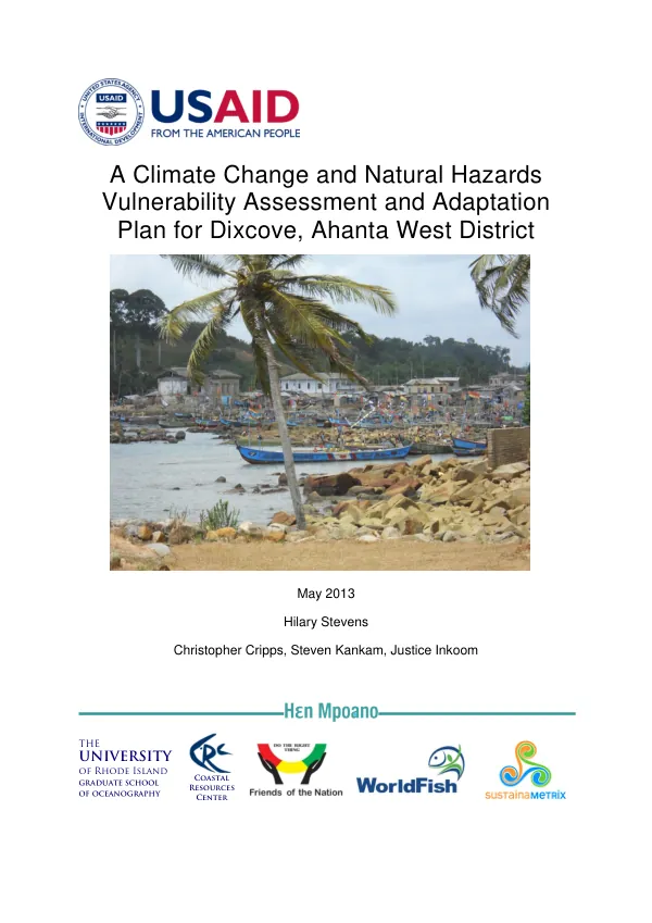
The coastal town of Dixcove, located in the Ahanta West District of Ghana's Western Region, is vulnerable to the impacts of climate change.
2013 · 21 pages
Sign in to readA free account is required to download.
Abstract
The town's physical characteristics, including its shoreline, are susceptible to erosion and flooding due to rising sea levels and increased storm intensity. The community's livelihoods, primarily based on fishing and tourism, are also at risk due to changes in ocean temperatures and chemistry. The town's exposure to climate change is exacerbated by its location in a low-lying area, making it more susceptible to flooding and erosion. The shoreline in Dixcove has eroded dramatically in recent years, with satellite images showing significant loss of land. Anecdotal evidence suggests that the erosion is even more severe than what is visible in the images. The community's sensitivity to climate change is also a concern. The town's economy and livelihoods are heavily dependent on fishing and tourism, which are both vulnerable to changes in ocean conditions. The fishery profile for the area indicates that the fish stocks are declining, and the tourism industry is also facing challenges due to the degradation of the shoreline and the loss of beach amenities. The adaptive capacity of the community is limited, with inadequate infrastructure and limited resources to respond to climate-related disasters. The town's spatial planning policies, including the 2012 National Infrastructure Plan and the Western Region Spatial Development Framework, do not adequately address the impacts of climate change on the town. A thorough vulnerability assessment is necessary to understand the impacts of climate change on the town and to develop an adaptation plan that will fit into the overall development plan for the community. This assessment requires an understanding of the physical impacts of climate change on the town, how the livelihoods and well-being of the residents are being affected, and what adaptive capacity the community possesses. The vulnerability assessment for Dixcove indicates that the town is highly vulnerable to climate change, with a high exposure to climate-related hazards and a limited adaptive capacity. The assessment also highlights the need for an adaptation plan that will address the impacts of climate change on the town's economy, livelihoods, and infrastructure. The adaptation plan for Dixcove should focus on shoreline management options, including beach nourishment and coastal protection structures. Spatial planning action points should also be implemented to address the impacts of climate change on the town's economy and livelihoods. The plan should also prioritize the development of infrastructure and resources to enhance the community's adaptive capacity. The implementation of the adaptation plan will require the involvement of district officials, community leaders, and local stakeholders. The plan should be integrated into the overall development plan for the community, and it should be regularly reviewed and updated to ensure that it remains relevant and effective. The vulnerability assessment and adaptation plan for Dixcove are critical components of the Hen Mpoano program's efforts to improve governance in the Western Region of Ghana. The plan will help to enhance the capacities of district officials and community leaders to incorporate coastal resources management and governance into their planning efforts, and it will ensure that natural hazards and vulnerabilities are accounted for and integrated into their strategies.