USAID/OFDA
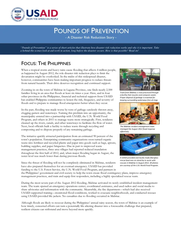
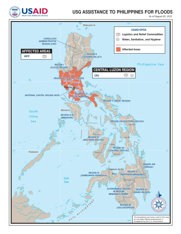
USG ASSISTANCE TO PHILIPPINES FOR FLOODS
The Philippines Sea is a marginal sea located in the western Pacific Ocean, situated south of China and east of the Philippines.
2012 · 1 pages
Sign in to readA free account is required to download.
Abstract
It is bounded by the Sulu Sea to the south and the South China Sea to the west. The sea's surface temperature ranges from 10° to 15° Celsius, with a maximum depth of approximately 5,000 meters. The Philippines is an archipelago with a total of 7,641 islands, stretching from the northernmost island of Babuyan to the southernmost island of Mindanao. The country is divided into 18 regions, with the National Capital Region (NCR) being the most populous. The regions are further subdivided into provinces, with a total of 81 provinces in the country. The regions of the Philippines are: Region I (Ilocos Region), Region II (Cagayan Valley), Region III (Central Luzon), Region IV-A (Calabarzon), Region IV-B (Mimaropa), Region V (Bicol Region), Region VI (Western Visayas), Region VII (Central Visayas), Region VIII (Eastern Visayas), Region IX (Zamboanga Peninsula), Region X (Northern Mindanao), Region XI (Davao Region), Region XII (Soccsksargen), Region XIII (Caraga), and the Autonomous Region in Muslim Mindanao (ARMM). The Philippines is prone to natural disasters, including typhoons, floods, and landslides. The country's geography is characterized by a mix of mountains, valleys, and coastal areas, making it vulnerable to these types of disasters. The country's climate is tropical, with two main seasons: the wet season from May to October and the dry season from November to April. As of August 20, 2012, the Philippines was affected by floods, with the Central Luzon Region being one of the most affected areas. The World Food Programme (WFP) and the United States Agency for International Development (USAID) provided assistance to the affected areas, including logistics and relief commodities. The assistance was focused on providing aid to the affected communities, including water, sanitation, and hygiene facilities.